The external sensors you’ll find in the modern car
If a picture is worth a thousand words, what happens when you add sonar, radar, lidar, GPS, WPS, weather conditions, and a dozen other data points to the mix? The images of the world that vehicle sensors create could fill an epic novel… multiple times… every day.
Electronic components grow continually smaller and cheaper to manufacture. In turn, tech that is rare and expensive one day often becomes widely available a short time later. To make that tangible, consider comparisons like the fact that a 2010 smartphone had the same processing power as a 1985 super computer.
The latest and greatest vehicles have a multitude of high-tech sensors. But, as tech components grow cheaper, better, faster, stronger – and as those features prove to make for better & safer driving experiences – we can expect to see them become standard equipment.
So if your connected car can see the world, what are the parts of the picture?
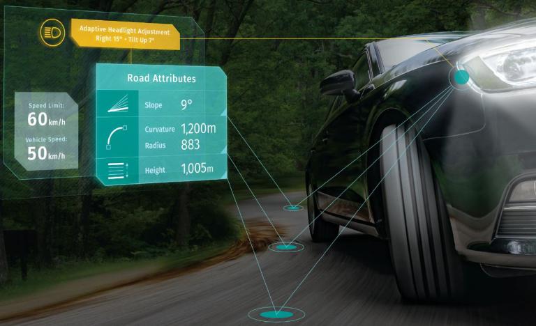
Temperature
A simple but important measurement, most current model cars detect exterior temperature. They often display this information where it’s visible to drivers and passengers, advising when temperature may impact car performance, or simply when it’s sweater weather.
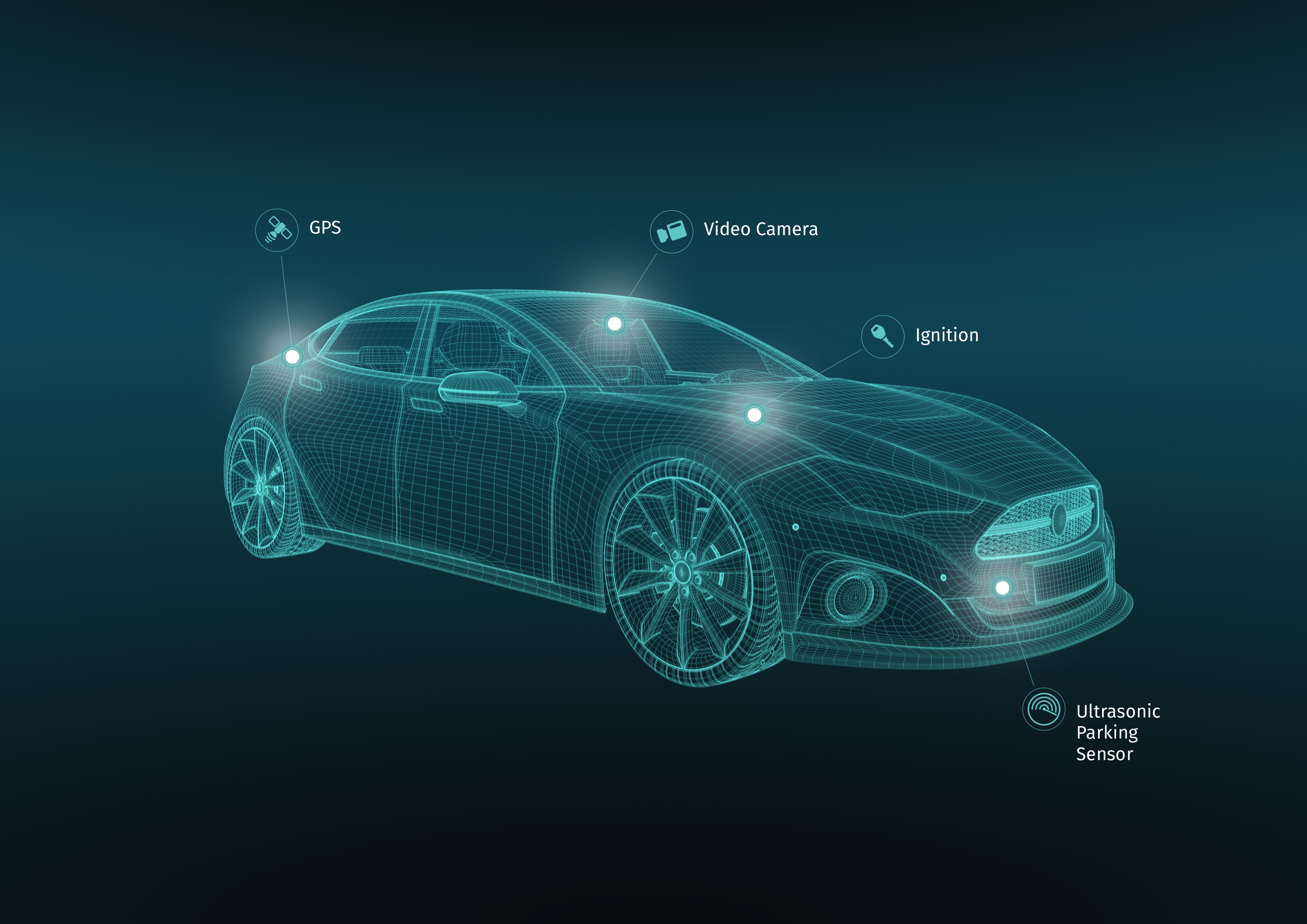
Cameras
Rear-facing, or “back up” cameras will be mandatory in U.S. autos in 2018. Similar front-facing cameras are already widely available but are not yet standard features. On the other hand, high-end vehicles now have advanced features like surround-camera systems and night vision.
One important note about cameras is that while they’re intended to make cars safer, they accompany an ongoing debate about privacy. The legality of dash cams can be mixed based on where you are in the world, and legislation for them may extend to safety cameras.
That aside, visual data that can be interpreted by humans and AI systems alike is one of the best sensor inputs for creating a digital representation of reality.
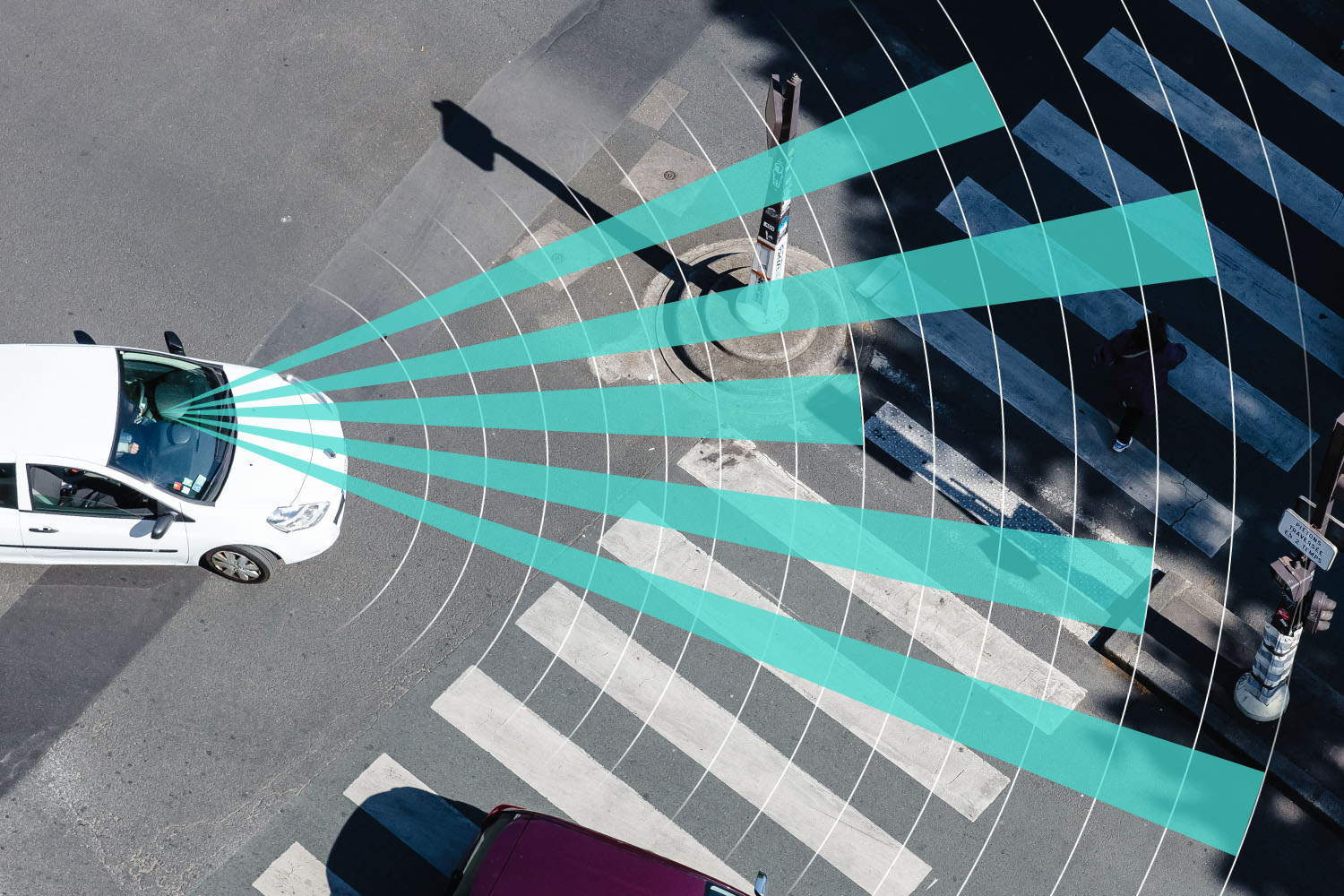
Radar
Radar sensors at the front, rear and sides have become an essential component in modern production vehicles. Though most frequently used as part of features like parking assistance and blind-spot detection, they have the capability to detect objects at much greater range – several hundred feet in fact.
Radar sensors are excellent at detecting objects, but they’re also excellent for backing up other sensors. For instance, a front-facing camera can’t see through heavy weather. On the other hand, radar sensors can easily penetrate fog and snow, and can alert a driver about conditions obscured by poor conditions.
Sonar
Like radar, sonar (or ultrasonic sensors) can detect objects in the space around the car. Ultrasonic sensors are much more inexpensive than radar sensors, but have a limited effective range of detection. Because they’re effective at short range, sonar sensors are frequently used for parking assistance features.
LiDAR
As Radar is to radio waves, and Sonar is to sound, LiDAR (Light Detection and Ranging) uses lasers to determine distance to objects. It does this by spinning a laser across its field of view and measuring the individual distances to each point that the laser detects. This creates an extremely accurate (within 2 centimeters) 3D scan of the world around the car.
Currently, LiDAR units are very big, and fairly expensive. You will most often see them mounted on Mapping Vehicles, but as the technology becomes cheaper, we’ll likely see them on trucks and high-end cars in the near future.
GPS & WPS
The Global Positioning System is the perfect example of how sensor technology grows smaller and more ubiquitous over time. Originally introduced for military applications in 1974, GPS probes today can be found in cameras, watches, key fobs, and of course, the smartphone in your pocket.
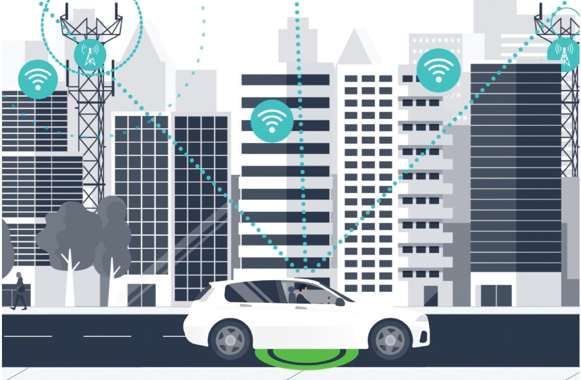
The lesser-known WPS stands for Wi-Fi Positioning System, which operates similarly. When a probe detects satellites (GPS) or Wi-Fi networks (WPS), it can determine the distance between itself and each of those items to render a latitude & longitude. The more devices a GPS/WPS probe can detect, the more accurate the results. On average, GPS is only accurate to around 20 meters.
This list covers the majority of types of tech that your car uses to detect the world around it. However, this is only the starting point. These sensors report the conditions of car’s exterior, but what does a modern vehicle have to say about itself?
In the next part of this series, we’ll look at features and technologies that make a car aware of itself, and how AI systems put that data to good use.

Sign up for our newsletter
Why sign up:
- Latest offers and discounts
- Tailored content delivered weekly
- Exclusive events
- One click to unsubscribe