Insights & Trends
Thanks to HERE Location Reasoning, your AI knows where it is
HERE Technologies — 14 October 2026
8 min read
30 July 2026
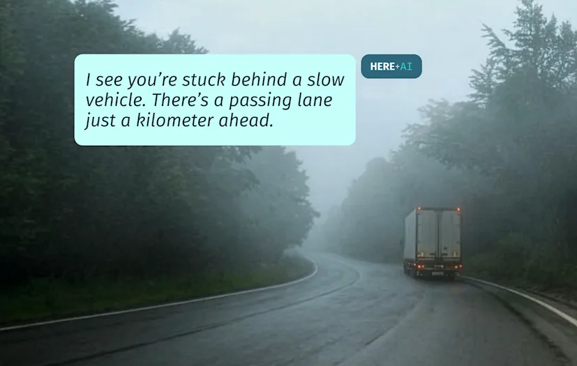
Mapping is evolving faster than ever. Artificial intelligence (AI) systems can now process road signs, lane markings, aerial images and vehicle sensor data at a scale that’s impossible for humans to match.
But roads are constantly changing. Temporary speed limits, construction work and lane changes mean maps need to keep pace without turning every signal into an update.
The system needs to know what a sign means, which road it applies to, whether it’s temporary or permanent, and if enough evidence supports a change before the map is updated.
“Vision models can understand what a scene represents,” said Dr Sanjay Boddhu, Head of AIML Engineering at HERE Technologies. “But they don’t know what a sign means to the road, what a road means to the lane and what a lane means to possible construction.”
That’s the difference between recognizing the world and mapping it.
It’s also why the map is becoming more important as AI moves from answering questions to taking action. If an AI system is expected to plan a route, support a delivery, recommend a stop or help a driver make a decision, it needs a reliable model of the real world supporting it.

Read more: Why LLMs understand language but not space
Sanjay gives the example of a temporary speed limit during roadworks.
A road that normally has an 80km/h speed limit may temporarily drop to 20km/h during construction. When the work ends, the old limit returns. That sounds simple. In reality, the evidence can be confusing.
A sign may be partially obscured. One vehicle might detect the temporary 20km/h limit, while another doesn’t. Traffic behavior may suggest the construction has ended, but the system still needs to be sure.
“This is the real world,” added Boddhu. “This is how observations happen.”
That’s why a trusted map can’t change because one vehicle, one camera or one AI model has seen something once.
“We cannot update a map on just a single drive,” said Boddhu. “We need multiple drives in that area.”
Confidence, in this context, means knowing how much trust to place in an observation. If more vehicles pass the same location and no longer detect the temporary sign, and traffic is flowing at the normal speed again, confidence increases.
“Once we get to a point where enough evidence is saying that the sign which was 20 km/h because of construction is no longer present, that increases my confidence,” added Boddhu.
Put simply, the map isn’t updated because AI has made a plausible guess. It’s updated because enough evidence points in the same direction.
That distinction matters because a map isn’t just a set of roads and coordinates. For an AI system acting in the physical world, it’s a model of reality.
It tells the system not only where things are, but how they relate to each other: which road connects to which lane, which restrictions apply, which routes are possible, where traffic is moving, what has changed and what can be trusted.
That requires specialist mapmaking knowledge.
“The point is not to use a general AI model and hope it understands roads,” said Boddhu. “It’s not a general expert. It’s a very deep, narrow vertical expertise.”
Modern mapmaking uses many sources, from aerial images and vehicle sensors to probe data and existing map information. Each source can reveal something useful. But none is perfect in isolation.
The freshest source may be noisy. The clearest image may be old. A vehicle sensor may detect a sign, but not know whether it’s temporary, obscured, lane-specific or still valid.
“No one source can give full confidence,” said Boddhu. “And the source that can give you full confidence might not be available at a fresher rate.”
This is why HERE’s mapmaking expertise matters. The challenge isn’t simply collecting more data. It’s turning many imperfect signals into one trusted picture of the world.
That trusted picture becomes essential when AI systems are asked to act. But acting in the physical world changes the stakes. A chatbot can give a plausible answer, but an AI agent has to do something useful with it.
In transportation and logistics, that could mean planning a route, selecting a stop, dispatching a vehicle, supporting a delivery or helping a driver make a decision in real time.
Out in the real world, “probably right” isn’t good enough. A route that almost works may send a truck down a restricted road.
So the map determines whether the task can actually work.

Read more: Enabling spatial reasoning for LLMs
Aleksandra Kovacevic, Senior Director of Responsible AI at HERE gives a simple example: driving from Naperville, a suburb of Chicago, into downtown Chicago.
“If I ask you to find me all the coffee shops between Naperville and downtown Chicago where I can get matcha tea, until now, there hasn’t been a tool that can do that,” said Kovacevic.
The request has to be resolved spatially: “between” doesn’t mean near the start or near the destination. It means somewhere along the route. It has to calculate that route, identify realistic stopping points, understand exits and detours, check which places are accessible and find options that fit the request.
“Most routing APIs understand the start and the destination,” said Kovacevic.
But HERE Location Reasoning can calculate routes, geocode places, find accessible options and visualize the spatial answer using the map, routing services, traffic, road attributes and network conditions.
A fleet system may need to know whether a truck can legally and safely make a turn. A field-service tool may need to dispatch the right technician based on location, traffic, time and job constraints. An in-car assistant may need to find a charging point before the driver reaches the airport, without suggesting a stop that is technically nearby but impractical to reach.
Each request combines language, location and constraints and the answer has to be fast, consistent and reliable.
The map therefore isn’t background information, it’s the infrastructure beneath the answer.
Boddhu sees this as part of a broader shift in mapmaking: moving from separate, feature-specific processes toward a more connected system that can understand how the world is changing and update the digital map accordingly.
“If I wanted to explain this to my eight-year-old daughter, I would say there is one AI system that can understand how the world is changing in reality and update a map in the digital space,” he said.
That’s the foundation for reliable AI in the real world. Because once AI moves from answers to actions, quality is no longer measured by how convincing the response sounds. It’s measured by whether it works.

Ian Dickson
Contributor
Share article
HERE Technologies — 14 October 2026
Louis Boroditsky — 09 October 2026
Tomi Agócs — 02 October 2026
Why sign up:
Latest offers and discounts
Tailored content delivered weekly
Exclusive events
One click to unsubscribe