Insights & Trends
Artificial Intelligence
Geospatial grounding in AI: a technical breakdown
Tomi Agócs — 02 October 2026
7 min read
21 August 2026
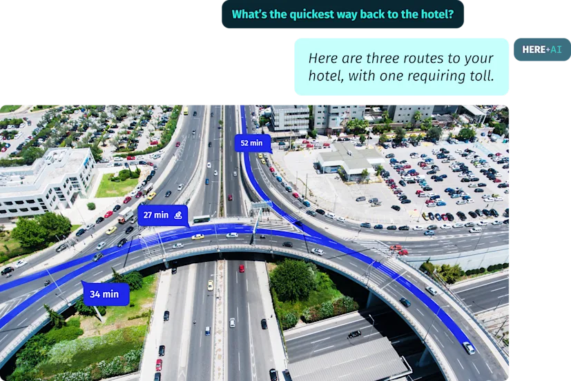
Picture this: you ask an artificial intelligence (AI) agent, "Where is my nearest cafe?".
The agent confidently gives you an address, a distance and directions. The only problem? None of it is accurate. Why? Because when AI systems try to guess at location specific details such as coordinates or distances, instead of looking it up, the result will often be inaccurate.
Geospatial grounding could address this problem by connecting AI agents to authoritative geographic data sources. The agent pulls real location facts such as store coordinates, routing constraints, traffic conditions and infrastructure data and reasons over them to produce an answer grounded in sourced data. It’s key to note that the large language model (LLM) might still perform probabilistic guesswork to formulate the final response.
Think of it as giving AI a reliable map to work from. Without it, LLMs operate like someone navigating from memory, filling in the gaps with almost accurate but unreliable information. With geospatial grounding, the agent has a deterministic foundation of location facts to pull from, providing better accuracy.
This matters more and more as AI systems move beyond conversation and into real-world action. For technical architects building location-dependent AI products or agentic workflows and product strategists evaluating location-based AI solutions, geospatial grounding is the missing data foundation that makes accurate, location-aware decision-making possible at scale.

Read more: Why AI needs a map of the real world
Standard LLMs fail at spatial reasoning because they are trained on text patterns, not geographic computation. These models answer location-based questions by predicting what sounds most likely, instead of basing their responses on real geographic data. The result sounds confident but gets distances, directions and place relationships wrong.
For instance, an LLM can tell you that Paris is in France and describe the Eiffel Tower in detail, but it cannot calculate the walking distance between two addresses reliably or identify which of three stores is closest to a user's current location. This happens because text prediction models lack the computational tools that spatial reasoning requires.
This creates real problems for businesses. When a customer asks an AI chatbot to find the nearest store, the model may return an address that no longer exists, suggest an impossible travel time or point to a location that is farther away than other options. These errors damage user trust and hurt retailers, logistics companies and service providers that depend on AI to answer location queries.
Geospatial grounding is a specific type of knowledge grounding that anchors an agent's outputs to verified spatial data and computed results, while agentic reasoning is the broader thinking framework that allows AI agents to tackle complex problems through logic, planning and self-correction.
Even with grounding, an LLM still runs the reasoning, and LLMs are optimized to predict likely text, not to compute distances, evaluate routing constraints or judge spatial relationships. So even with the right data and validation systems in hand, the agent can miscalculate which store is actually closest, misjudge a constraint like a road closure or draw the wrong spatial conclusion from correct inputs.
Because good data doesn't guarantee good spatial reasoning over that data. This is where geospatial grounding needs to work alongside dedicated spatial computation, not just alongside agentic reasoning.
Geospatial grounding gives agentic reasoning the factual foundation it needs, including coordinates, distances, real-time traffic data or current business information sourced from authoritative databases. But facts alone don't produce a correct answer. Something still has to compute the distance, check the constraint or compare the options.
That's why location reasoning agents pair grounded data with purpose-built spatial computation. Pairing strong agentic reasoning with solid geospatial grounding and real spatial computation is what produces agents that can handle complex spatial queries with accuracy.
HERE Location Reasoning is built to deliver exactly this kind of grounded, computation-backed spatial execution layer for AI systems.

Read more: Enabling spatial reasoning for LLMs
A location reasoning layer breaks down a spatial query into structured steps of execution and calls the right resources to retrieve verified geographic data in real time, so responses draw on the correct, authoritative sources.
Think of it like a research assistant has access to the latest maps and records before answering, instead of relying on memory, as well as the ability to identify the right resources while keeping track of where they are kept and how to access them efficiently. This approach treats location data as a live retrieval layer that the agent queries on demand, but with the support of a location reasoning layer, ensuring answers are correct and reliable.
Once the agent retrieves the spatial data, it shapes it into a clear, natural language answer to the user's question.
When enterprise AI agents handle complex queries, accuracy and consistency matter. No matter how the query is posed or under which circumstances, the system provides trusted answers that can be acted upon. This is because responses are deterministically computed in runtime using trusted data sources. And it's the elimination of guesswork that makes agentic responses reliable in real production environments.
Geospatial grounding connects AI agents to verified geographic data so they can deliver accurate location-based responses instead of generating unreliable information from text patterns.
Standard LLMs train on text patterns, not geographic data, so they cannot reliably calculate distances, determine proximity or account for real-world constraints like traffic conditions and road closures.
A location reasoning agent pulls verified geographic data from authoritative sources before generating a response, while a standard AI agent relies on its training data alone, which often leads to confident but incorrect answers to spatial queries.
Location reasoning agents handle tasks like finding nearby locations, calculating travel times, providing real-time routing, answering geographic questions and optimizing logistics operations.
Geospatial grounding stops AI hallucinations by pulling verified, real-time location data from authoritative geographic databases rather than generating plausible-sounding but potentially incorrect answers from training data alone.

Maja Stefanovic
Senior Writer
Share article
Tomi Agócs — 02 October 2026
HERE Technologies — 14 October 2026
Louis Boroditsky — 09 October 2026
Why sign up:
Latest offers and discounts
Tailored content delivered weekly
Exclusive events
One click to unsubscribe