APIs
Refactoring your HERE application with AWS Kiro and MCP-powered documentation
Alberts Jekabsons — 28 September 2026
10 min read
22 September 2026
Imagine asking an AI assistant to find a restaurant halfway between you and a friend. It sounds like a simple request, and the assistant may confidently suggest a place. But how did it decide what “halfway” means?
The AI assistant may have chosen a restaurant near the geographic midpoint between your locations. That point could be across a river, next to an inaccessible highway exit or in a part of the city that takes one person much longer to reach. A fair meeting place is not necessarily halfway in distance. It is more likely to be somewhere both people can reach in roughly the same amount of time.
Answering that question properly requires more than knowledge about restaurants or neighborhoods. It requires routes, travel times, current traffic, road access and a search radius for places within the area that works for both travelers. In other words, it requires spatial computation.
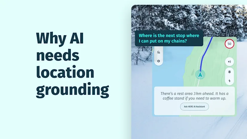
This is the gap location grounding is meant to address: connecting AI systems to real-world spatial computation and location intelligence that provides awareness of dynamic conditions.
Ask a large language model (LLM) about Paris, San Francisco or Tokyo, and it can describe the city in impressive detail. It may know which neighborhoods are popular, which landmarks people visit and how residents commonly travel. Because the response sounds informed, it is easy to assume that the model understands the city itself.
What the model understands exceptionally well is language. It has learned patterns from enormous amounts of text, including the ways people describe places and movement—but language models are not designed to provide deterministic routing, traffic-aware travel times or other location outcomes derived from spatial data. It may know that two places are nearby without knowing that a bridge, restricted turn or traffic jam makes the journey between them difficult.
On HERE360, the blog post "Why LLMs understand language but not space" highlights a key distinction: understanding how a place is described is not the same as reasoning about its spatial relationships.
That distinction was less consequential when AI mainly answered questions. It becomes much more important as AI agents begin to take action. Agents are being asked to plan trips, coordinate deliveries, dispatch field teams, recommend charging stops and make decisions that affect people and physical operations. A response that merely sounds reasonable is no longer enough.
Four simple questions that are not actually simple |
|---|
The nearest place may not be the fastest to reach |
Consider the request, “Find the nearest urgent care.” Nearest could be interpreted as the shortest straight-line distance. But one needs to also take into account the feasibility of reaching there, two-wheeler driving times vs walking time could be different. The seemingly simple query has multiple hidden parameters to consider for an answer that is reliable enough to act on. If the user needs urgent care, the useful answer is probably the facility they can reach fastest, not the one whose coordinates happen to be closest. |
A useful midpoint is rarely just a point on a map |
The restaurant midpoint presents a similar problem. Drawing a straight line between two people and selecting its center ignores the roads available to each traveler. One person may have direct freeway access while the other must cross town on local streets. Finding a practical midpoint requires comparing travel times and identifying places that are genuinely reachable for both. |
EV charging requires context, not just search |
Now consider an electric vehicle driver asking for a charging stop along a route. A basic place search can return nearby chargers, but proximity alone does not make a charger useful. The decision may depend on the expected energy consumption, charger compatibility, availability, the planned route and the time added by a detour. Several of those conditions can change while the vehicle is moving. |
Routes need to account for changing conditions |
A route that works under normal conditions may no longer be the best option when conditions change. A road closure, live traffic, temporary restriction or seasonal access rule can alter which route is available or practical. An agent making decisions in the physical world therefore needs routing based on the relevant current conditions, rather than assuming that a previously known or seemingly logical route is still valid. |
As explained in the HERE360 blog post "Why does AI give wrong directions?", reliable directions depend on more than knowing where two places are. They require an understanding of how the road network can actually be used.
These are spatial problems expressed in everyday language. Each one depends on complex combination of geometry, travel time, restrictions, reachability and dynamic data.
Larger and better-trained models will improve how agents interpret location-related questions, identify missing details and choose tools. But understanding a spatial request and providing a factually correct and trusted answer are different kinds of problems.
A model can learn from descriptions of millions of routes without becoming a routing engine. Routing requires a connected road network and algorithms that evaluate possible paths under specific constraints. It also depends on the current information. Roads close, traffic changes, businesses move and charging stations become occupied.
This is not simply a training-data problem. Language understanding and spatial computation solve different problems. Reliable spatial outcomes depend on current data, spatial computation and real-world constraints.
The practical approach is to let each system do what it does best. The language model understands the request and recognizes when spatial reasoning is required. A geospatial tool then helps calculate the route, travel time, reachable area or other location result using the relevant constraints and current information. The agent uses that structured result to answer the user or continue the workflow.
For the restaurant request, the agent could identify both starting points, compare travel times, find a practical meeting area and search it for suitable restaurants. The final response still feels conversational, but its location output comes from computation rather than the model’s memory.
Providing an LLM with tocation Tools is only the first step. A production application also needs clear rules for when tools are used, which constraints are passed to them and what happens when reliable results are unavailable.
Questions involving routes, travel times, reachability, restrictions or current conditions should trigger a location tool rather than rely on the model’s memory.
Travel mode, departure time, vehicle type, accessibility requirements and acceptable detours can all change the answer.
A general city recommendation may tolerate older place information. Dispatching a vehicle or rerouting a driver may require live traffic and recent map data.
If traffic information is unavailable or charger availability cannot be confirmed, the agent should say so instead of presenting an estimate as fact.
These decisions are what turn a convincing location-aware AI demo into a dependable application.
Location grounding is not about teaching an AI model the name of every road or asking it to memorize a map of the world. It is about connecting language intelligence to current data and dependable spatial computation.
As agents take on more responsibility, location will sit behind many of the decisions they make: where something is, how to reach it, what is nearby, which constraints apply and what has changed. The LLM provides a natural interface to the user’s intent. Geospatial tools provide the real-world context needed to act on that intent.
As explored in the HERE360 blog post "What is geospatial grounding in AI?", grounding connects AI systems to authoritative geographic context, so location-based decisions can be tied to the physical world.
The future of location-aware AI is not bigger models, it is models that know when to use the right tools. That is how we move from answers that sound right to decisions that can be computed, checked and trusted.
If you’re interested in learning more about how HERE is helping build AI grounded in real-world location intelligence, watch this space.

Mohini Todkari
Sr. Developer Evangelist
Share article
Alberts Jekabsons — 28 September 2026
Bhavin Pun — 16 September 2026
Alberts Jekabsons — 04 September 2026
Why sign up:
Latest offers and discounts
Tailored content delivered weekly
Exclusive events
One click to unsubscribe