
how-to
Community
APIs
HERE Geocoding & Search API: Developer Insights & Best Practices
Piyush Pelagade — 18 May 2026
11 min read
15 June 2026
Developers rely on the HERE Routing API suite to solve route planning, route optimization, fleet routing, EV routing, GPS trace matching, reachability analysis, and large-scale distance matrix calculations.
The HERE Routing (Routing API, Route Matching, Matrix, Isoline, and Waypoints Sequence) has seen consistent developer activity in the community. These insights can help you design more robust routing workflows, avoid common pitfalls, and build smarter location-based applications. This blog post captures the most relevant developer questions and community insights around HERE Routing, focusing on practical implementation patterns, API capabilities, and production-ready best practices.
1. How to Avoid Ferries, Toll Roads, and Other Features with HERE Routing API?
Developers frequently asked how to shape routes beyond the default fastest path.
Topics included:
• Avoiding ferries and toll roads
• Adjusting route preferences based on road types
• Customizing routing behaviour for different transport modes
Example request:
https://router.hereapi.com/v8/routes?origin=54.398112,10.218645&destination=54.397898,10.181888&return=polyline,summary,actions,instructions&transportMode=car&avoid[features]=ferry&apikey=[api_key]Community guidance:
• Avoid parameters influence routing decisions but do not act as strict exclusions
• Routing behaviour depends on road classification and available alternatives
• These parameters are best used as preferences, not guarantees. More information here.
2. How to Calculate a Route Using HERE Routing API?
This was one of the most fundamental but frequently revisited questions.
Typical request structure:
https://router.hereapi.com/v8/routes?origin=54.398112,10.218645&destination=54.397898,10.181888&return=polyline,summary,actions,instructions&transportMode=car&apikey=[api_key]Community guidance:
• A valid request requires origin, destination, and transport mode
• Additional parameters refine routing behavior and response detail
• Responses are structured into sections with summary and metadata, More information here.
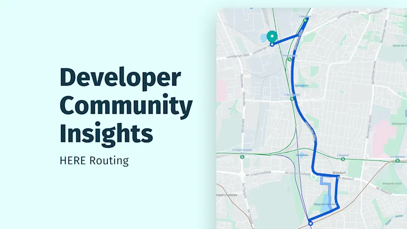
3. How to Retrieve Route Geometry and Polylines for Map Visualization?
As with Maps API usage, rendering routes efficiently was a recurring topic.
Example request:
https://router.hereapi.com/v8/routes?origin=54.176519,10.061794&destination=54.135125,10.097282&return=polyline,summary,actions,instructions&transportMode=car&apikey=[api_key]Community guidance:
• Route geometry is returned using flexible polyline encoding
• The geometry can be decoded and rendered directly in map clients
• Request only when needed to optimize response size, More information here.
4. Does Routing API support bus-specific routing such as BRT or dedicated lanes?
This question came up in simulation and transport modelling scenarios.
Topics included:
• Dedicated bus lanes (e.g., BRT systems) & Real-world public transport routes
• Speed profiles and stop modelling
Guidance:
• transportMode=bus is supported (currently in beta)
• Routing can consider bus-restricted roads and lanes reserved for buses/taxis
• Full public transit workflows (including stops and schedules) are not handled via Routing API
• GTFS-based public transport routing is a different capability and not part of standard routing flows
Example request:
https://router.hereapi.com/v8/routes?origin=&destination=&return=polyline,summary,actions,instructions&transportMode=bus&apikey=[api_key]Reference: Bus and taxi routing in Routing API
5. Why do routes differ between Routing API and HERE WeGo Pro?
Developers noticed inconsistencies when comparing routes across platforms.
Observed issues:
• Different routes generated for identical inputs
• Variations even in simple scenarios
Community guidance:
• Routing always triggers a new calculation, even with identical parameters
• Results can differ due to Traffic conditions/Incidents along the way
• Using: departureTime=any can reduce time-dependent variation
• Vehicle-specific parameters significantly impact results
• In one case, setting weightPerAxle resolved route discrepancies
Debug tip: Use the Routing Demo Client to compare behaviours
Reference: Routing API developer guide
6. What country codes are supported in exclude[countries] parameter?
Developers encountered validation issues when excluding certain regions.
Observed issue: Using XKX (Kosovo) resulted in a 400 error
Guidance:
• Routing API does not always follow ISO standard codes
• Supported value for Kosovo is KOS (KOS should be in upper case)
Example:
https://router.hereapi.com/v8/routes?origin=43.346085,20.012287&destination=42.057558,21.365604&return=polyline,summary,actions,instructions&transportMode=car&exclude[countries]=KOS apikey=[api_key]Reference: Country codes (HERE Map Object Model)
7. How to Calculate Travel Times with Matrix Routing API?
The Matrix Routing API is designed for large-scale travel time and distance calculations between multiple origins and destinations. It is commonly used in fleet routing, delivery optimization, dispatch systems, and logistics planning where calculating thousands of individual routes would be inefficient.
Topics included:
• Scaling origin-destination calculations & reducing repeated routing calls
• Supporting fleet and delivery use cases
Guidance:
• Matrix API returns travel time or distance as a structured matrix
• Suitable for high-volume routing scenarios & enables efficient precomputation of travel relationships. More information here.
• Take a look at this simple Matrix routing example
8. How are Matrix Routing transactions counted in large requests?
This came up in cost and scaling discussions.
Observed question: Whether a large matrix request counts as one transaction or multiple interactions
Community guidance:
• Matrix Routing billing and limits depend on request structure and plan. Detailed transaction counting logic is defined in official documentation
• For large-scale usage, refer to the knowledge base or pricing documentation
Reference:
• Matrix Routing API
• KB Article
9. How can I calculate reachable areas based on time, distance, or consumption using Isoline Routing API?
Reachability analysis was a common requirement across applications, with developers exploring different ways to define “reachable area” depending on their use case. Isoline Routing API is commonly used for drive-time analysis, service area mapping, delivery coverage planning, store catchment analysis, and emergency response applications.
Topics included:
• Time-based reachability (isochrones) for delivery or travel-time scenarios
• Distance-based reachability (isodistance) for coverage and proximity use cases
• Consumption-based reachability for EV and fuel-based vehicle scenarios
Example request (time-based isoline):
https://isoline.router.hereapi.com/v8/isolines?transportMode=car&origin=LAT,LNG&range[type]=time&range[values]=SECONDSCommunity guidance:
• Isoline API supports multiple range types: time, distance, and consumption
• Time-based isolines represent areas reachable within a duration (isochrones)
• Distance-based isolines represent areas reachable within a specified distance
• Consumption-based isolines support EV and fuel scenarios using vehicle-specific parameters
• Results are returned as polygons and can be used for both visualization and analysis. More information here.
10. How to Optimize Multi-Stop Routes with Waypoints Sequence API?
Route optimization emerged as a key topic in 2025 discussions, especially for logistics, delivery, and service workflows.
Topics included:
• Delivery route optimization & service scheduling
• Multi-stop navigation and sequencing. Structuring inputs for accurate optimization
Example request:
https://wps.hereapi.com/v8/findsequence2?start=WiesbadenCentralStation;50.0715,8.2434&destination1=FranfurtCentralStation;50.1073,8.6647&destination2=DarmstadtCentralStation;49.8728,8.6326&destination3=FrankfurtAirport;50.0505,8.5698&destination4=HanauCentralStation;50.1218,8.9298&end=MainzCentralStation;50.0021,8.259&improveFor=time&departure=2014-12-09T09:30:00%2b01:00&mode=fastest;car;traffic:enabledCommunity guidance:
• Waypoints Sequence API determines the optimal stop order based on time or distance
• A request requires a start point and one or more destinations. The end point can be explicitly defined or inferred
• Parameters such as improveFor, departure, and mode influence optimization results
• All waypoints are treated as mandatory inputs within the optimization model
Reference: Waypoints Sequence API
11. What is Route Matching API and How Does GPS Trace Matching Work?
As routing implementations matured, developers increasingly worked with real-world GPS traces and explored how to convert raw tracking data into meaningful insights. Route Matching API (also known as map matching) is commonly used to convert raw GPS traces into road-aware data that can be analyzed for compliance, route validation, speed analysis, and fleet monitoring.
Topics included:
• Matching GPS traces to the underlying road network. Cleaning noisy, sparse, or inaccurate tracking data
• Enriching route data with map attributes for analysis. Using matched data for analytics, monitoring, and reporting
Example: Basic Demo
Guidance:
• Route Matching maps GPS traces to the most likely route
• Returns map attributes such as road characteristics and speed limits
• Supports use cases like route validation, monitoring, and post-trip analysis
Reference: Route Matching API
12. Can I use Route Matching API to retrieve speed limits?
Developers explored using Route Matching to extract map attributes such as speed limits from GPS traces.
Observed issues:
• 429 Too Many Requests errors despite valid usage
• Uncertainty about whether Route Matching is the correct API for this use case
Community guidance:
• Route Matching API is not available on base/self-serve plans & 429 response in this context indicate access limitations rather than rate limits.
• Speed limit data is available through Map attribute API, but these may also require specific access plans
References:
• Route Matching API
• Contact to Sales may be required for access depending on subscription plan
13. How should slope data from Route Matching API be interpreted and scaled?
Advanced use cases involved extracting ADAS attributes such as slope from route matching responses.
Observed challenges:
• Understanding slope encoding format (e.g., "SLOPES": "-368,375,84...")
• Aligning low-frequency API outputs with high-frequency telemetry data
Guidance:
• Slope data is part of static map attributes associated with road links. Interpretation (encoding, units, scaling) may require deeper product-specific clarification
• High-frequency resampling or interpolation logic is application-dependent. For detailed ADAS attribute handling, support or account teams should be engaged
Reference:
• Route Matching API
• Map Content- Slope
13. Where can I find OpenAPI (Swagger) specifications for Routing API?
Developers using machine-readable API specs faced issues after documentation updates.
Observed issues:
• Legacy docs URLs (docs-be.here.com) no longer accessible
• Missing YAML/JSON OpenAPI definitions
Guidance:
• OpenAPI specs are now available directly via API endpoints. For Routing API, the specification can be accessed here
• Additional specs may be discoverable through the documentation portal via Ask AI feature.
References:
• Docs portal
• API Reference
Depending on your use case, you may combine multiple HERE routing services:
API | Common Use Case |
|---|---|
Routing API v8 | Route calculation and navigation |
Matrix Routing API | Travel time and distance matrices |
Isoline Routing API | Reachability and service area analysis |
Waypoints Sequence API | Multi-stop route optimization |
Route Matching API | GPS trace matching and map attribute enrichment |
The HERE Routing API ecosystem provides developers with a complete toolkit for route planning, matrix calculations, route optimization, GPS trace matching, and reachability analysis. Whether you're building logistics software, delivery platforms, fleet management systems, EV navigation solutions, or location intelligence applications, these APIs help solve real-world routing challenges at scale.
We encourage you to join the conversation, ask questions, and share your learnings. It continues to be one of the strongest assets in the HERE developer ecosystem.
• Routing API v8
• Matrix Routing API
• Isoline Routing API
• Waypoints Sequence API
• Route Matching API
• Routing Demo Client

Piyush Pelagade
Share article
Piyush Pelagade
Piyush Pelagade — 18 May 2026
— 31 March 2026
Piyush Pelagade — 20 February 2026
Why sign up:
Latest offers and discounts
Tailored content delivered weekly
Exclusive events
One click to unsubscribe

