Developers
Integrations
What made HERE switch from C++ to Rust?
Alberts Jekabsons — 23 August 2025
5 min read
15 July 2026
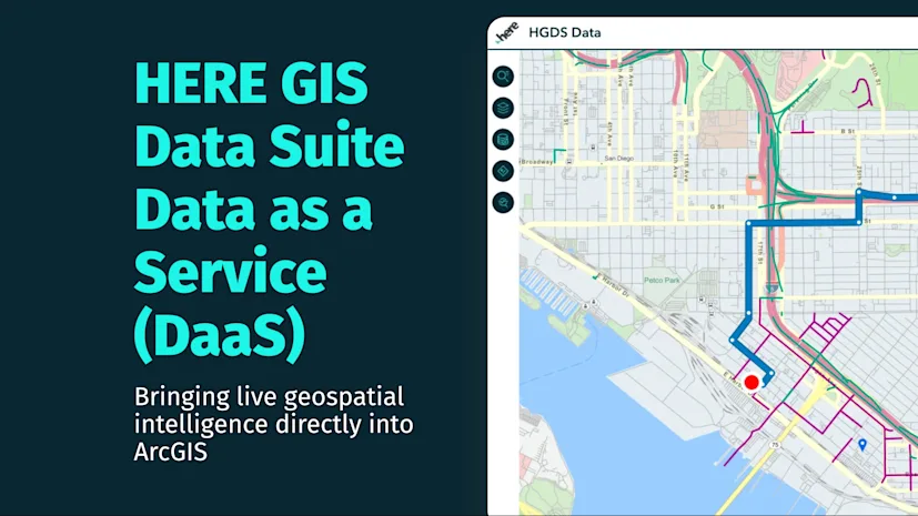
For years, enterprise GIS teams have followed the same pattern: download large datasets, publish services, manage infrastructure, update data, republish services, and repeat.
The new Data as a Service (DaaS) capability in HERE GIS Data Suite simplifies that workflow by exposing HERE data through ready-to-use REST services. Instead of downloading and hosting datasets, GIS teams can connect directly to HERE services and use them immediately within existing workflows.
DaaS delivers HERE location intelligence through REST services rather than downloadable datasets. You can connect directly to a service endpoint and consume HERE data as a standard GIS layer without having to manage the underlying datasets yourself.
A service endpoint can be added directly into:
ArcGIS Pro
ArcGIS Enterprise
ArcGIS Online
Custom applications that support Esri REST services
Once connected, the service behaves like any other GIS layer. You can:
Visualize data on a map
Query attributes
Perform spatial analysis
Use the data in existing GIS workflows
Integrate the services into custom applications
Because the data is delivered through services, there is no need to download, host, or continuously update large datasets.
Routing is one of the clearest examples of how DaaS can be integrated into existing GIS workflows. By connecting a HERE routing service to ArcGIS Enterprise, users can perform network analysis that incorporates HERE transportation attributes, including road-level truck restrictions.
Rather than simply calculating the shortest path, routing can incorporate real-world truck attributes such as:
Vehicle height restrictions
Weight restrictions
Restricted road segments
For example, a route generated for a 16-ton truck with a 5-meter height will avoid roads that cannot legally or safely accommodate that vehicle. Low bridges, restricted tunnels, and weight-limited segments are automatically considered during route calculation. This helps planners and analysts generate routes based on real-world transportation constraints instead of relying on generic road network calculations.

Direction with custom truck mode
Green: truck height restrictions, Purple: truck weight restrictions
Traffic conditions change constantly, making them difficult to manage as static datasets. Using HERE live traffic services, ArcGIS users can visualize current traffic conditions directly within their GIS environment.
Traffic flow is displayed on road segments, while incidents such as accidents, closures, and disruptions can be explored through standard ArcGIS tools. Because the information is delivered through a live service, users are always working with current traffic conditions rather than periodically updated data extracts.

For developers and GIS teams, this means there is no traffic dataset to download, update, or republish. The latest traffic intelligence is available whenever an application requests it, making it easier to build operational dashboards, monitoring applications, and traffic-aware workflows.
Routing explains how to travel between two locations. Origin-Destination (OD) analysis answers a different question: how are people actually moving across a city?
Using HERE OD services within ArcGIS Enterprise, analysts can visualize aggregated movement patterns between an area of interest and surrounding locations. In our example, inbound and outbound trips around San Diego's Gaslamp district are displayed using flow lines and H3 aggregation zones, making it possible to identify where trips originate, where they end, and which areas have the strongest connections.

Rather than focusing on a single route, OD analysis provides a broader view of mobility patterns and network connectivity. These insights can support transportation planning, infrastructure investment, demand analysis, and location intelligence workflows.
DaaS doesn't introduce a new GIS workflow - it removes steps from the existing one.
By exposing HERE location intelligence through REST services, HERE GIS Data Suite allows organizations to consume authoritative routing, traffic, and mobility data without managing the underlying datasets. If you're already building solutions with ArcGIS, DaaS makes it easier to bring HERE location intelligence into your applications while reducing the overhead associated with hosting and maintaining GIS data.
Learn more about HERE GIS Data Suite at here.com/solutions/gis-data-suite.

Mohini Todkari
Sr. Developer Evangelist
Share article
Alberts Jekabsons — 23 August 2025
Sachin Jonda — 13 February 2025
Alberts Jekabsons — 17 December 2024
Why sign up:
Latest offers and discounts
Tailored content delivered weekly
Exclusive events
One click to unsubscribe