
Map content & data
HERE GIS Data Suite: Foundational Location Data for ArcGIS Pro
Mohini Todkari — 29 July 2025
7 min read
28 April 2026
In many GIS workflows, accurately describing where something occurs along a road network is critical. While coordinates (latitude and longitude) describe where a location exists in space, they do not capture where along a road segment an event or asset is positioned.
This becomes important in scenarios such as road network analysis, infrastructure management, and geospatial data processing, where multiple events may occur along the same segment and require precise, network‑relative positioning.
M‑values help address this gap by enabling a consistent way to represent positions along linear features such as roads. This approach is widely used in linear referencing systems and supports a range of GIS analytics and data processing workflows.
An M‑value is a measure of position along a linear feature – specifically how far along a road segment a given location is, expressed as a numeric distance from a defined starting point.
In standard GIS, every point on a map is described by x and y coordinates, which are longitude and latitude. That tells you where something is in space. But for many real-world applications, knowing where along a road something occurs matters just as much.
An M‑value adds that third dimension of meaning: distance along the network.
For example, instead of describing an incident occurring at coordinates -87.6534, 41.8827, you can describe it as occurring 347 meters along Link ID 112458903. This description is meaningful to anyone managing that road segment, regardless of map projection or coordinate system.
This concept is called Linear Referencing, and it is the foundation of how GIS teams in transportation agencies, logistics operators, and infrastructure managers describe locations along roads and other linear networks in a way that is operationally meaningful rather than just spatially precise.
In GIS workflows, M‑values enable capabilities that are difficult or impossible to achieve using x, y coordinates alone.
Many events or assets can be associated with the same road link, such as a long urban segment containing multiple reference points, observations, or assets.
M-values provide a network-aware position reference for each delivery stop, tied to a specific HERE road link and direction of travel. When passed into a routing or optimization engine, this positional precision supports more accurate stop sequencing, especially useful on dense urban segments where multiple addresses share the same road link.
In many GIS use cases, different functional locations associated with the same asset or structure may map to different road segments or positions along the same segment.
M‑values allow GIS professionals to record and distinguish these locations based on their precise linear position along the network. This level of detail supports more accurate representation of real-world infrastructure in geospatial datasets.
HERE historical traffic data is referenced by Link ID and direction of travel. Once events or assets are linearly referenced, historical speed and congestion data can be directly associated with specific positions along a road segment.
This enables more accurate enrichment and analysis of network-based data, supporting workflows that require spatial correlation between events and underlying road attributes.
When analyzing changes over time, M‑values provide a stable reference frame along the road network.
Because HERE link IDs are designed to remain stable across quarterly map updates, event tables built today remain joinable to updated network geometry, making longitudinal analysis reliable.
Linear referencing is not new. Enterprises and public works departments have used M‑values for decades to manage crash locations and infrastructure assets along road networks.
Crash locations are commonly recorded using milepost or station references. By geocoding incidents against a road network and deriving m‑values, agencies can place events at precise positions along routes and analyze patterns over time. The same approach is used to manage pavement conditions, signage, and utilities as linear events along road segments.
These established GIS workflows demonstrate how linear referencing supports accurate modeling and analysis of network-based data.
What makes HERE GIS Data Suite particularly well suited for generating and using M‑values is the consistency between the geocoding reference and the road network.
Because the HERE locator and HERE street network are built from the same underlying map content, a geocoded address and the route it snaps to share the same geometry. This reduces the risk of conflation errors commonly introduced when joining geocoding and routing data from different vendors.
Combined with quarterly updates and persistent link identifiers, this provides a stable linear referencing foundation for production workflows.
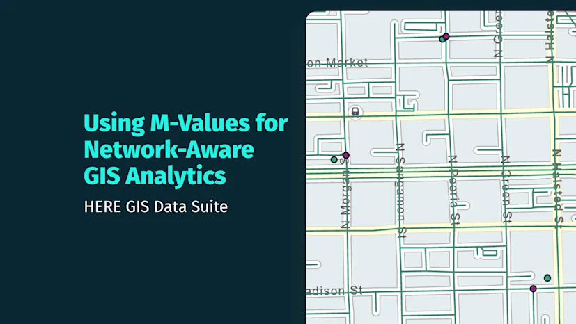
Run Create Routes (ArcGIS Pro Linear Referencing tool) on the HERE street network using LINK_ID as the route identifier. This creates an m‑aware route feature class with measure values stored along each segment.

Load your address table and run Geocode Addresses using the HERE locator. The result is a point feature class with one x, y location per address.
Run Locate Features Along Routes (ArcGIS Pro Linear Referencing tool) using the geocoded points and the m‑enabled route feature class. Set a search radius of approximately 25 meters to snap points to the nearest route. The output is an event table containing LINK_ID and MEAS (M‑value).

Run Make Route Event Layer (ArcGIS Pro Linear Referencing tool) to display the newly created M-value points back on the map against the HERE network.

M‑values provide a practical way to represent positions along a road network, enabling more accurate and meaningful GIS analytics. By moving beyond standalone coordinates, they allow geospatial professionals to work with data in a way that reflects how real-world infrastructure is structured and managed.
This makes them particularly valuable for GIS teams working on transportation networks, infrastructure analysis, and data processing workflows that require precise, network‑aware positioning.

Sam Chapman
Solution Architect
Share article
Mohini Todkari — 29 July 2025
Sachin Jonda — 25 November 2024
Aaron Falk — 25 June 2024
Why sign up:
Latest offers and discounts
Tailored content delivered weekly
Exclusive events
One click to unsubscribe

