-
-
Platform Overview Platform Overview
High-precision data and advanced tooling in one place
-
Maps & Data Maps & Data
Build high-quality maps using fresh location data
Maps & Data-
Map Data Map Data
Create fresh, accurate maps and layer global information
-
Dynamic Map Content Dynamic Map Content
Explore industry-leading map content
-
Maps for ADAS & HAD Maps for ADAS & HAD
Help vehicles see beyond sensors with location data sources
-
-
Services Services
Browse our extensive range of services and APIs
Services-
Routing Routing
Make journey planning easier with our routing portfolio
-
Geocoding & Search Geocoding & Search
Translate addresses into accurate geocoordinates
-
Map Rendering Map Rendering
Highly customizable graphics and real-time map data
-
Positioning Positioning
Pinpoint devices and assets locations with precision
-
-
Tools Tools
Build solutions with our flexible developer tools and applications
Tools-
HERE Studio HERE Studio
Visualize, style and edit location data
-
HERE Workspace HERE Workspace
Create location-centric products and services in one space
-
HERE Marketplace HERE Marketplace
Source, buy, sell and trade location assets
-
HERE SDK HERE SDK
Build advanced location-enabled applications
-
HERE Live Sense SDK HERE Live Sense SDK
Enhance driver awareness by using AI
-
HERE Anonymizer HERE Anonymizer
Maximize location data while supporting regulatory compliance
-
-
Capabilities Capabilities
Everything you need for your location-related use case
Capabilities-
Visualize Data Visualize Data
Identify complex trends and patterns
-
Generate Insights Generate Insights
Transform location data into compelling stories
-
Build Applications Build Applications
Create feature-rich products designed for business
-
Develop Services Develop Services
Produce tailored service experiences
-
Make Maps Make Maps
Create and use custom digital maps
-
-
-
-
By Market By MarketBy Market
-
Automated Driving Automated Driving
-
Connected Driving Connected Driving
-
Fleet Management Fleet Management
-
Supply Chain Supply Chain
-
Urban Mobility Urban Mobility
-
Infrastructure Planning Infrastructure Planning
-
Public Safety Public Safety
-
-
By Applications By ApplicationsBy Applications
-
HERE Last Mile HERE Last Mile
Optimize your last mile deliveries
-
HERE Asset Tracking HERE Asset Tracking
Track assets in real-time with our end-to-end solution
-
HERE Navigation HERE Navigation
Use our off-the shelf navigation system
-
HERE WeGo HERE WeGo
Enjoy your journey with our new navigation app
-
-
-
-
Partner with HERE Partner with HERE
-
Partner Network Partner Network
-
-
Pricing Pricing
-
-
Documentation Documentation
-
Tutorials Tutorials
-
Code Examples Code Examples
-
Knowledge Base Knowledge Base
-
Developer Blog Developer Blog
-
-
-
About us About us
-
Events Events
-
News News
-
Press Releases Press Releases
-
Careers Careers
-
Sustainability Sustainability
-
Leadership Leadership
-
Investors Investors
-
HERE360 Blog HERE360 Blog
-
HERE powered app of the week: GPX Viewer

This week’s app is a great example of how the HERE maps that power navigation and location services on Windows Phone can be used by developers to create new functionality.
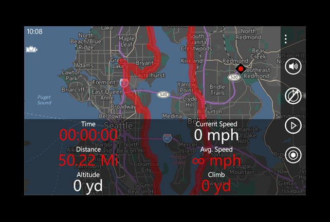
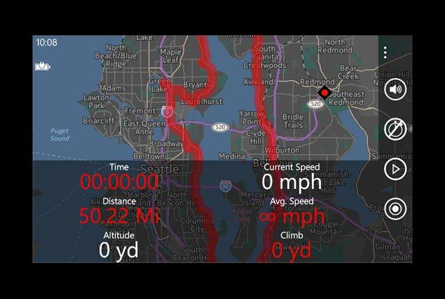
GPX Viewer is an app to create, view and follow GPX tracks while you’re out and about.
If you’re not familiar, GPX is a file format used by runners, cyclists, hikers and more to plan, record and share their routes.
This is useful in different ways for different people.
Preparation = half the battle
If you’re cycling or hiking, and visiting a new place, it might be a good idea to follow someone else’s route the first time you’re there. Go to a site like Wandermap, Wikiloc or MapMyRide to get started.
For a runner, planning a route that is the exact distance you’re aiming for in your training is trickier than it sounds. Mapping one out beforehand or downloading someone else’s can avoid the frustration of discovering you’ve bitten off more than you can chew, or the boredom of running round the local park eight times.
GPX files include climb and altitude information, which can be very important: a five-mile run that’s entirely up-hill is a very different proposition to one that’s flat all the way!
Track suits
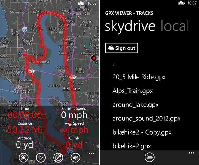
So there are two main ways to use GPX Viewer. If you’re recording a new route, then hit the record button in the app and off you go. Once you’ve finished, you can upload your GPX track to OneDrive and share it, or add it to an online account.
If you’re following a route you have created or downloaded on a computer, the process is the opposite. Download the GPX file from whichever site you use and stick it on OneDrive. Then pick it up from there within the app.
The app will follow you on your route and record stats as you go. Because it uses HERE maps, it doesn’t need a data connection, assuming you have your local map downloaded to your phone. So no matter how far off the beaten track your route takes you, you’ll continue to be located and guided. If you’re cross-country skiing or deep in a national park, this will be an important advantage.
There are other Windows Phone apps that perform a similar function – Runtastic is a notable example. But we liked GPX Viewer because its use of the open GPX format for routes means it will work with pretty much any third-party service for planning and sharing routes.
We hope the app proves useful to some of you. Are you using this or an alternative?
Have your say
Sign up for our newsletter
Why sign up:
- Latest offers and discounts
- Tailored content delivered weekly
- Exclusive events
- One click to unsubscribe