Can video games save Notre-Dame?
New reports on the Notre-Dame fire have revealed how shockingly close the cathedral came to collapsing. Could video game research be key in bringing the historic cathedral back?
Modern map makers have a directive to capture the details of the world as accurately as possible. That data, in precise digital formats, is then put to task in efforts to enable better city planning, autonomous vehicles, and yes, even better video games.
Following the tragic cathedral fire in Paris, it's been suggested that the 3D scans and research conducted by video game developers could help the reconstruction efforts – and it very well could.
As graphics technology becomes ever more sophisticated, game developers capture audiences' attention and imagination by creating incredibly detailed digital worlds. These allow players, and people, to experience things they would never be able to otherwise.
This kind of digital accuracy can most frequently be found in racing games. The racing simulator Assetto Corsa sees the player driving around recreations of real tracks from around the world.
Similar to the way that autonomous vehicles require precise data of their road conditions, the game’s creators used millimeter accurate laser-scanning to accurately render every detail of the course, down to the bumps and dips in the road. In fact, this level of detail in environmental capture enables professional drivers to train on tracks long before they arrive at the real-world locations.
3D mapping can build a lost city
What happens when data capture shifts from recreating roadways, to recreating ancient places? The Assassin’s Creed series presents the avatar of an acrobatic rogue in various historical settings, encouraging players to climb and interact with the highly detailed architecture.
Although the series has been criticized for some historical inaccuracies, it sets itself apart with impressive recreations of long-destroyed cities.
The most recent installment takes place in Ancient Greece and involves recreations of cities like Athens and Sparta. In order to let players experience these cities as realistically as possible, the creative team consulted with historians and pulled heavily from historical texts and archeological evidence.
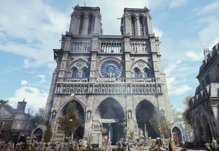
The same tools and approaches used in creating 3D models of cities that have never been seen with modern eyes can also be applied to preserve our living cities and landmarks. In fact, in the wake of the Notre Dame fire, some pointed out that game creator Ubisoft had a highly accurate model of the famous church created from years of painstaking research, which could be used to restore it.
Lidar technology can help restore what we've lost
Highly accurate measurement tools like lidar and computer visioning might be gaining new employment to create incredibly detailed fantasy worlds. However, those same technologies have already been hard at work for years in digitizing world heritage sites, and historic neighborhoods.
These levels of capture detail are the same as those we build into the HERE HD Live Map, which will enable autonomous cars to accurately navigate around the world.
While the gaming industry might be capitalizing on the lidar scans, it's unlikely the developers at Ubisoft considered that their work has the potential to help restore history.
Whether good for a lap around the track, preserving our cities for the future, or giving an educational glimpse into the past, three-dimensional maps made with lidar and computer visioning are giving us unimaginable, interactive access to whole new vistas.
Notre Dame isn't the first landmark to benefit from precise 3D mapping. Learn more about our long history in using lidar to map and preserve environments.

Have your say
Related articles


Sign up for our newsletter
Why sign up:
- Latest offers and discounts
- Tailored content delivered weekly
- Exclusive events
- One click to unsubscribe